Imperial Beach, CA Neighborhood Guide: Homes, Schools, and Beach Life
A local guide to Imperial Beach, CA: the pier, beaches, Tijuana River Estuary, sandcastle heritage, schools, getting around, and current home prices.
San Diego County · 7 min read
Overview
Imperial Beach is the southernmost beach city in San Diego County, built around a wooden fishing pier, a wide sandy beach, and the adjacent Tijuana River Estuary. Locals call it "IB."
The city is the southwesterly-most incorporated city in the continental United States, about 14 miles south of downtown San Diego and 5 miles northwest of Tijuana, Mexico. It covers 4.41 square miles (4.29 square miles of land and 0.12 square miles of water) at an elevation of 20 feet.
Imperial Beach is bordered by Coronado and the Silver Strand to the north, San Diego Bay to the northeast, the Tijuana River Valley and Border Field State Park (and Tijuana, Mexico) to the south, and the Pacific Ocean to the west.
Imperial Beach calls itself the birthplace of the U.S. sandcastle-building tradition and still hosts an annual sand-sculpture festival, and the city adjoins the Tijuana River National Estuarine Research Reserve, the largest coastal wetland remaining in Southern California.
Thinking about Imperial Beach?
Talk it through with Nataliya Fonseca — buying, selling or just weighing the move.
Things to Do
Imperial Beach's landmarks center on its pier, its beach, and the estuary and refuge lands at its southern edge.
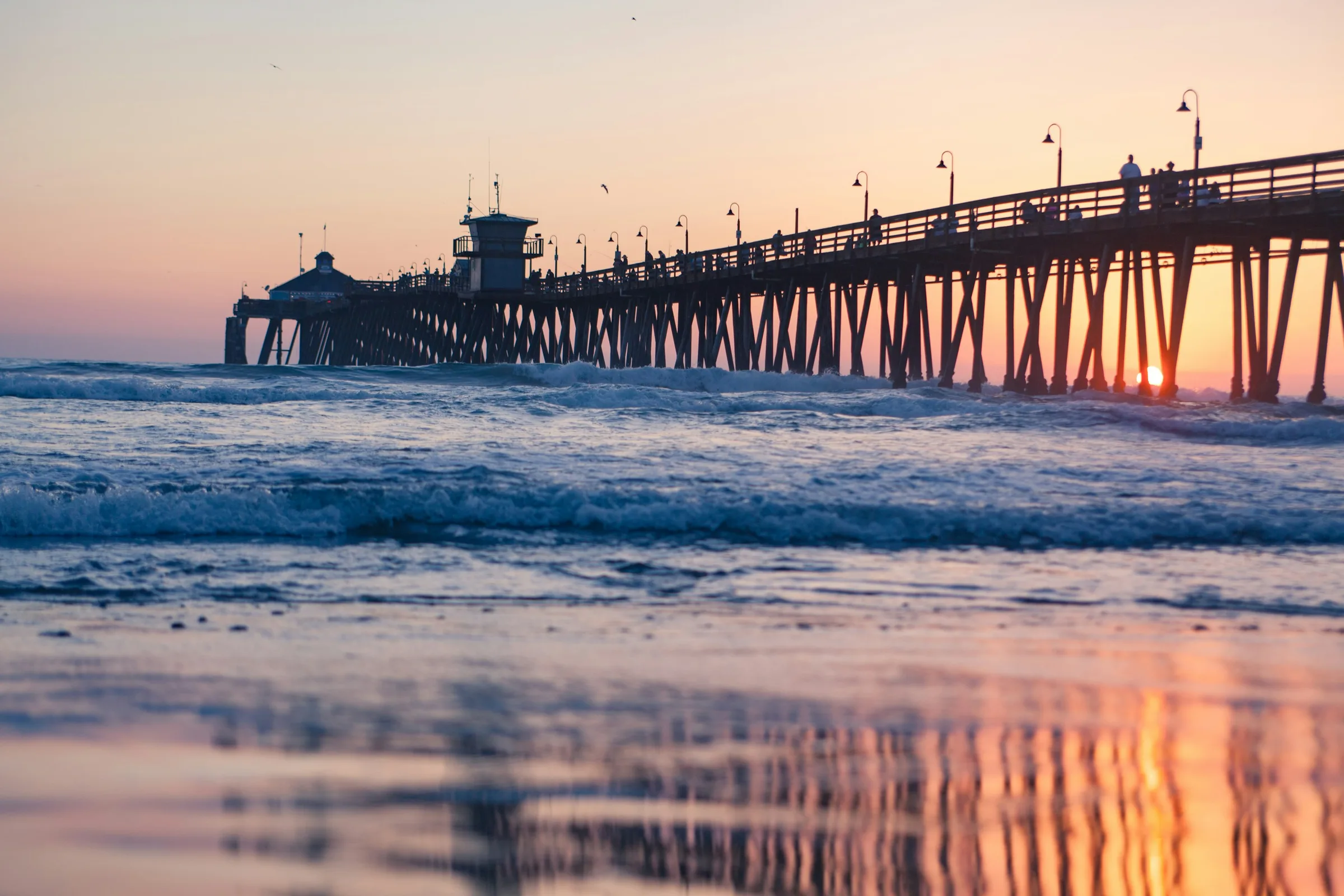
- Imperial Beach Pier — a 1,491-foot wooden fishing pier open 5 a.m. to 10 p.m., the southernmost pier in California, with sunset and ocean views and a restaurant at the end.
- Portwood Pier Plaza — a beachfront plaza at the pier entrance with seating, restaurants, and a weekly farmers' market.
- Imperial Beach — about 4 miles of sandy beach used for surfing, sport fishing, and beach volleyball.
- Tijuana River National Estuarine Research Reserve / Tijuana Estuary Visitor Center — the largest coastal wetland in Southern California, with 4 miles of trails, guided bird walks, and a Pacific Flyway stopover for more than 370 bird species.
- Tijuana Slough National Wildlife Refuge — an adjacent federal wildlife refuge protecting salt marsh and estuary habitat at the river mouth.
- Border Field State Park — a state park at the U.S.-Mexico border with beach access and coastal bluff trails.
- Silver Strand State Beach / Silver Strand corridor — the barrier-strip beach and roadway connecting Imperial Beach to Coronado, adjacent to Naval training facilities.
The Sun & Sea Festival, an annual sand-sculpting festival at Portwood Pier Plaza, is the successor to the original U.S. Open Sandcastle Competition.
Dining and Shopping
Most dining in Imperial Beach sits along Seacoast Drive near the pier.
- Brigantine Seafood & Oyster Bar — an oceanfront seafood and oyster bar on Seacoast Drive.
- SEA180° Coastal Tavern — an oceanfront American seafood restaurant inside the Pier South Resort.
- Sammy's Restaurant & Bar — an ocean-view breakfast, lunch, and dinner spot at Pier South Resort.
- Imperial Beach Kitchen — a casual eatery on Seacoast Drive near the pier.
- The Tin Fish — a casual seafood spot built into the end of the Imperial Beach Pier.
The Imperial Beach Certified Farmers' Market sets up weekly next to Pier Plaza, Fridays from noon to 7:30 p.m.
Schools
Imperial Beach K-8 students attend the South Bay Union School District, which enrolls about 5,450 students across 13 schools district-wide, including Oneonta Elementary and Central Elementary. Grades 7-12 fall under the Sweetwater Union High School District, which also serves Chula Vista, National City, and Bonita, including Mar Vista High School.
Individual GreatSchools rating bands for Imperial Beach's schools were not confirmed for this guide. School data provided by GreatSchools.
Getting Around
State Route 75 (Palm Ave/Silver Strand Blvd) is the main highway through Imperial Beach, connecting to I-5 several miles east via SR-75 or Palm Ave.
MTS bus routes serve the city, including Routes 933 and 934 on an Iris Trolley Station loop to Imperial Beach, Route 901 between the Iris Transit Center and downtown, and Route 227 between Imperial Beach and the Otay Mesa Transit Center. The Palm Avenue Trolley Station on the Blue Line, several miles from central Imperial Beach, connects via bus Routes 932, 933, and 934.
Imperial Beach has a Walk Score of 69, a Transit Score of 36, and a Bike Score of 63 as of 2026. Scores provided by Walk Score®.
Housing and Market
Imperial Beach's housing stock is predominantly single-family beach cottages and small multi-family and duplex buildings near the coast, with some newer condo and townhome developments, according to local market sources.
Over the three months ending around July 2026, the median sale price in Imperial Beach was $852,000, or about $589 per square foot, with homes spending a median of 28 days on market.
Homes for sale
See what’s on the market in Imperial Beach right now.
By the Numbers
| Metric | Value |
|---|---|
| Population | 25,764 |
| Median age | 35.1 |
| Median household income | $79,071 |
| Median sale price (3 months ending ~July 2026) | $852,000 |
| Price per square foot | $589 |
| Median days on market | 28 |
| Walk Score | 69 |
| Transit Score | 36 |
| Bike Score | 63 |
Demographics from the 2024 5-year ACS for Imperial Beach city, California. Scores provided by Walk Score®.
Know Before You Buy
Imperial Beach has a mild coastal Southern California climate typical of San Diego's South Bay beach cities.
As a low-elevation oceanfront city sitting at about 20 feet in elevation, Imperial Beach carries coastal flooding and erosion risk typical of that setting; specific FEMA flood-zone designations were not confirmed for this guide.
Since 2023, cross-border sewage and industrial pollution flowing down the Tijuana River has caused near-continuous water-contact closures along Imperial Beach's shoreline, including areas near the pier, Tijuana Slough, and Seacoast Drive. The city maintains an ongoing Tijuana River Pollution FAQ and has invoked "rainy day" school schedules during pollution spikes. Buyers considering beachfront or near-shore property should review the city's current guidance before purchasing.
History
The Imperial Beach townsite was founded in June 1887 by developers marketing it as a cooler coastal retreat for residents of the inland Imperial Valley, which gave the city its name. Imperial Beach was incorporated as a city on July 18, 1956.
The city originated the U.S. Open Sandcastle Competition in 1981. The competition ran for 31 years, drawing crowds estimated as high as 325,000, before ending in 2011 and being succeeded by the Sun & Sea Festival in 2013.
Nearby Neighborhoods
Imperial Beach sits near other South Bay and coastal San Diego communities.
Frequently Asked Questions
What is it like to live in Imperial Beach, CA?
Imperial Beach is a compact oceanfront city built around its wooden pier, sandy beach, and the neighboring Tijuana River Estuary. The city calls itself the birthplace of the U.S. sandcastle-building tradition and still hosts an annual sand-sculpture festival. It has a Walk Score of 69, a Transit Score of 36, and a Bike Score of 63.
Is Imperial Beach a good place to buy a beach house near San Diego?
It depends on your priorities. Imperial Beach offers oceanfront living at a median sale price of $852,000, with direct beach and pier access. Buyers should also weigh the city's ongoing Tijuana River water-quality closures before purchasing beachfront or near-shore property.
What is the median home price in Imperial Beach, CA?
Over the three months ending around July 2026, Imperial Beach's median sale price was $852,000, or about $589 per square foot, with homes spending a median of 28 days on market.
Are Imperial Beach's beaches currently open or closed due to water quality?
Since 2023, cross-border sewage and industrial pollution flowing down the Tijuana River has caused near-continuous water-contact closures along Imperial Beach's shoreline, including areas near the pier, Tijuana Slough, and Seacoast Drive. The city maintains an ongoing Tijuana River Pollution FAQ with current status.
What school district serves Imperial Beach, CA?
Imperial Beach K-8 students attend the South Bay Union School District, and grades 7-12 fall under the Sweetwater Union High School District, which also serves Chula Vista, National City, and Bonita. School data provided by GreatSchools.
How far is Imperial Beach from downtown San Diego and the Tijuana border?
Imperial Beach is about 14 miles south of downtown San Diego and 5 miles northwest of Tijuana, Mexico.
What is the Imperial Beach Pier and what is there to do near it?
The Imperial Beach Pier is a 1,491-foot wooden fishing pier open 5 a.m. to 10 p.m., the southernmost pier in California, with a restaurant at the end. Nearby, Portwood Pier Plaza offers seating, restaurants, and a weekly farmers' market.
Is Imperial Beach walkable, and what public transit options are available?
Imperial Beach has a Walk Score of 69, a Transit Score of 36, and a Bike Score of 63. MTS bus routes 933, 934, 901, and 227 serve the city, and the Palm Avenue Trolley Station on the Blue Line connects via additional bus routes. Scores provided by Walk Score®.
Thinking about Imperial Beach?
Talk it through with Nataliya Fonseca — buying, selling or just weighing the move.